Modeling in the Geosciences
Numerical models are a novel tool used to predict changes, visualize processes, and identify relationships for the advance of scientific research. Models combine a culmination of years of scientific research in physics, statistics, and data collection into one place where scenarios can be interpreted and predicted. As with much of research within the geosciences, modelers have to reconcile with uncertainty and assumptions as they try to simplify the complexities of the real world into a comprehensible result. A modeler’s goal is not necessarily to recreate the exact reality of the geological world, but rather better define the bounds of what is possible or not possible in terms of processes, time, and scale to produce an observable phenomenon within data or physics.
In the Geosciences, one type of tool and field of study are Landscape Evolution Models (or LEMs). They are used to recreate processes at the surface. Based on physical equations, it is possible to look at the evolution of hillslopes, erosion, weathering, river incision, and sediment transport mechanisms. Time is of great importance, and different LEMs use different timescales from years to millions of years depending on the processes being modeled.
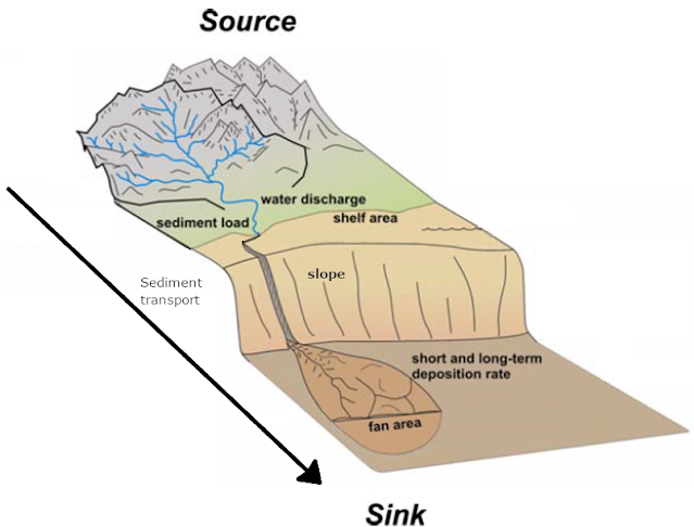
One model used within our studies of sediment routing systems from source to sink is a landscape evolution model called Fastscape (Bovy, 2021; Braun and Willet, 2013). Fastscape uses different modifications of the stream power law to simulate drainage, erosion, deposition, and topographic elevation of a landscape over geologic time. As an example, in figure 1 we show how Fastscape can be used to visualize the changes within topography and landscape response to changes in bedrock erodibility.
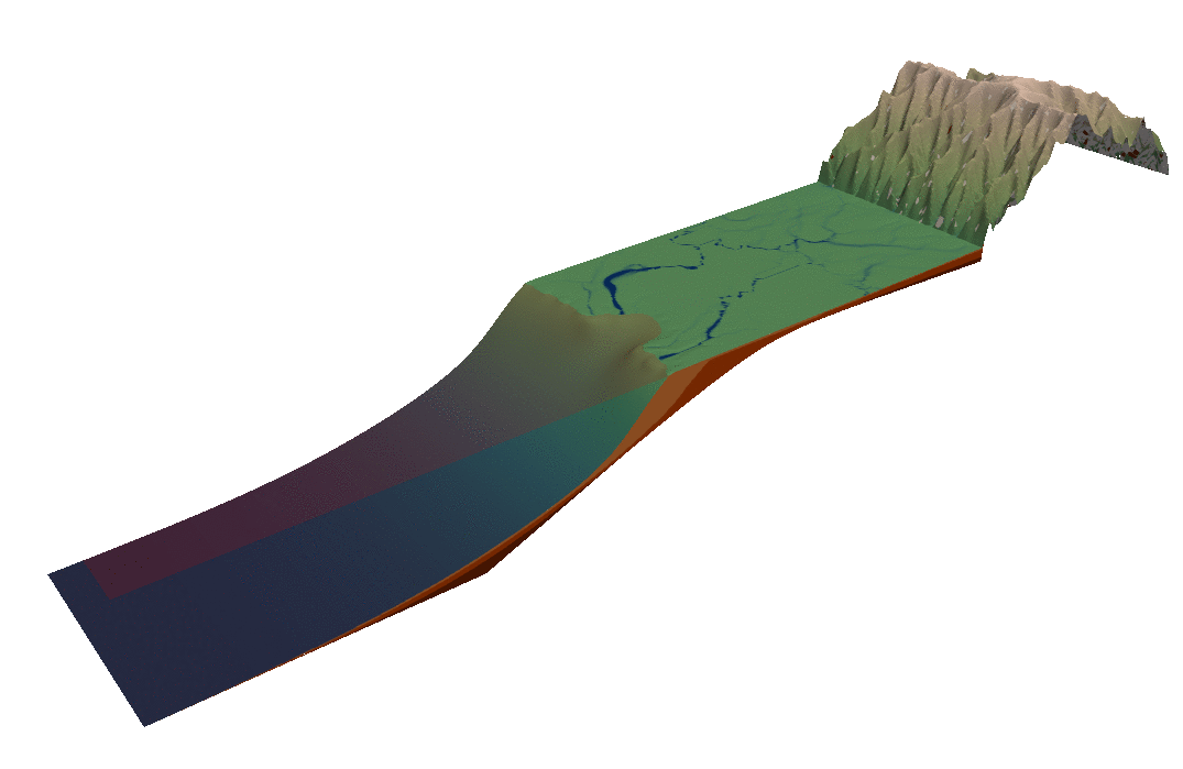
Figure 1: Sample Fastscape Landscape Evolution Model Set Up
Using Fastscape, geoscientists can assess the response of a catchment (drainage divide migration, erosion rates, channel dynamics, etc) to changes in precipitation, uplift, flexural subsidence and more. This is useful when trying to recreate external forcing events within the stratigraphic record, calculate sediment budgets, or analyze response times of a catchment. Fastscape has also been used to derive analytical solutions for landscape controls on fan extent and slope (Braun, 2022) based on geometries observable across different model simulations. Modeling is a constantly evolving scientific field and thus, updates and improvements of models are regularly made. For example, as part of our project, we develop new codes to add to Fastscape, incorporating new tools to the system.
The modeling world and incorporation of models by geoscientists is ever expanding and thus, we cannot even begin to summarize it within one blog post. Overall, the potential uses of a model go so far as the bounds of scientific inquiry-i.e essentially limitless.
References
Bovy, B. (2021). Fastscape-lem/fastscape: Release v0.1beta3 (0.1.0beta3). Zenodo: https://doi.org/10.5281/zenodo.4435110
Braun, J., & Willett, S. D. (2013). A very efficient O (n), implicit and parallel method to solve the stream power equation governing fluvial incision and landscape evolution. Geomorphology, 180, 170-179.
Braun, J. (2022). Comparing the transport-limited and ξ–q models for sediment transport. Earth Surface Dynamics, 10(2), 301-327.
Comments
Post a Comment