Methods to Investigate Source-to-Sink Systems
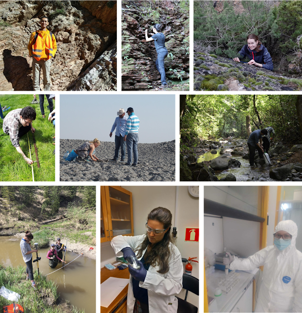
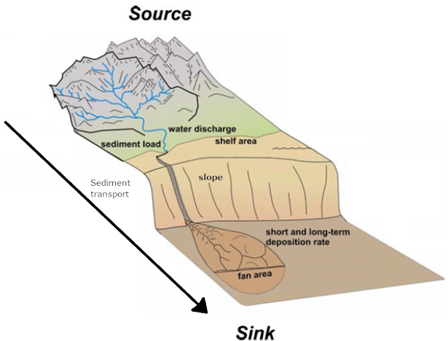
Much like building a complex puzzle, multiple components come together to foster an understanding of the evolution of S2S systems at various temporal and spatial scales. Some of these components are (1) understanding the major processes and fluvial dynamics acting on the system, (2) recognizing the changes or signals in the sedimentary record, (3) deciphering the environment necessary to produce a given signal within the record, and (4) contemplating other dynamics that would change the expression of an environmental event in the final rock/sediment record. Thus, studying S2S systems often requires an integration of research methods and the collaboration of specialists across different fields.
1. Fieldwork
Several field observation methods are essential in source-to-sink analysis. Here, we describe sedimentology, stratigraphy, and geomorphology as three of the most essential research methods. Other methods are generally based on their concepts and principles. Therefore, understanding their basics is fundamental for the application and interpretation of any method.
1.1 Sedimentology
Sedimentology is concerned with describing, classifying, and understanding the origin of sedimentary rocks. It helps us to understand the processes of formation, transportation, deposition, and diagenesis. The main goal is to interpret ancient environmental conditions of S2S systems by gathering fieldwork data from outcrops in terms of constituents, textures, structures, and fossils.
1.2 Stratigraphy
Stratigraphy studies the accumulation and distribution of layered rocks denominated strata in space. An important principle is Steno’s Law of Superposition, which says, “younger strata overlie older strata”. These principles in combination with interpretation of physical, biological and chemical properties of sedimentary layers help to define surfaces and units based on the vertical changes of those properties in the stratigraphic succession. There are several sub-disciplines of stratigraphy and each one focuses on investigating a set of properties. For instance, lithostratigraphy focuses on changes in lithology (physical properties like color, grain size, texture, composition), biostratigraphy focuses on changes in fossil content and requires expertise in paleontology (the science that studies life forms appearing, living, and being extinct at some point). It is also used for dating (see 3.2 Geochronology).
1.3. Geomorphology
Geomorphology investigates landforms, their processes, shapes, and sediments at the surface of the Earth. This observation includes looking at landscapes to understand how the Earth's surface processes, such as air, water, and ice, can shape the landscape. Most of the Earth's surface processes are changing the landscape very slowly but some are very rapid like landslides or floods. Advancements in remote sensing from satellites and GIS mapping such that we can see from Google Earth allow geomorphologists or even amateurs to understand the landscapes on a global scale.
2. Laboratory Analyses
Once field data has been collected and sorted in the field, analytical work can be performed in the laboratory setting. The laboratory methods are very specific and depend on the target of study, but in general, they involve the chemical and physical treating of rocks or minerals.
2.1 Mineralogy
During denudation, rocks are broken into sediments, and the material further “decomposes” and forms secondary minerals. In our systems, these newly formed minerals are clay minerals. The clay mineral composition reflects the environmental conditions during its formation, and thus the climatic conditions can be estimated. The process starts with separating the clay-sized particles from the coarser grains in the laboratory. The unaltered minerals and clasts in the sediment also give insight into the type of rocks from which the sediment originates (e.g., is it volcanic, does it originate from a continent or an oceanic crust?). This is based on the fact that rocks with a specific composition will generate sediments of similar composition. For example, if we have granite (an igneous rock with high feldspar and quartz content) after weathering and erosion we will most likely get feldspathic and quartz-rich sandstones, which is different from what we will get if we erode a basalt (volcanic rock) in the first place. The provenance of sediment will be examined further with geochronological methods afterward (see 2.3 Geochronology).
2.2 Geochemistry
2.3 Geochronology
- Relative dating does not provide a precise age, it just indicates if a specific rock or fossil is younger/older than others. Thus, this dating method relies on the Superposition Law (see 1.2 Stratigraphy).
- Radiometric dating gives a precise age (plus measurement of its uncertainty, e.g. 21.7 ± 0.8 Ma). It calculates an age in years for geologic materials by measuring the presence of radioactive elements, e.g., C14, K/Ar, etc.
3. Landscape Evolution Modelling (LEM)
LEMs have revolutionized the way geoscientists can compute the entire landscape over millions of years in less time than it would take to brew a cup of coffee. LEMs rely upon and illustrate the various relationships between geomorphic variables (such as terrain slope, sediment flux, watershed area, and more). Changes from the source to the sink due to climatic, tectonic, and lithologic events can be analyzed using a LEM. Findings derived through LEMs are validated with real-world field observations and have a vast breadth of applications.
As we have seen there are several methods to study source-to-sink systems and their components, and there are even plenty more that we have not covered yet. It is necessary to bear in mind that the most important thing is to understand how we integrate abundant data and complement different research methods in order to get the best picture of them.
If you have any questions about the methods described to study source-to-sink or do you want to know more about other methods, please leave a comment below! Thank you for reading and see you next month for the next post!
References:
Griffin, D. (2006). The late Neogene Sahabi rivers of the Sahara and their climatic and environmental implications for the Chad Basin. Journal of the Geological Society, London, Vol. 163, pp. 905-921. https://doi.org/10.1144/0016-76492005-049
Nichols, G. (1999). Sedimentology and stratigraphy. Oxford: Blackwell Science.
Palermo, D., Aigner, T., Nardon, S., & Blendinger, W. (2010). Three-dimensional facies modeling of carbonate sand bodies: Outcrop analog study in an epicontinental basin (Triassic, southwest Germany). American Association of Petroleum Geologists Bulletin, 94(4), 475–512. https://doi.org/10.1306/08180908168
Posamentier, H. W., & George P Allen. (1999). Siliciclastic sequence stratigraphy: Concepts and applications: SEPM Concepts in Sedimentology and Paleontology. In Concepts in Sedimentology and Paleontology (Issue 7).


Comments
Post a Comment