Rapid Processes in Source-to-Sink Systems - part II
The rock record as an answer for the future
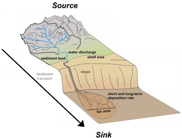
Environmental signals (originated from climatic or tectonic processes) can be preserved within the stratigraphy of depositional basins and in the physical features of the Earth’s surface - our landscapes. It is a geologist's task– and challenge – to use the rock record and landscapes to tell the story of how those processes affected a certain area for a certain period of time. It is not only fundamental to understand the Earth’s history through the sedimentary record, but unraveling the changes that happened in the sedimentary systems due to climate and tectonic perturbations can help us predict a number of responses of our planet, today and in the future. Romans et al. (2016) exemplify some of those predictions, such as: land-to-sea export and burial of terrestrial organic carbon, landscape resiliency and hazard management, natural resource exploration and production, as well as the response of hydrological systems to global climate change.
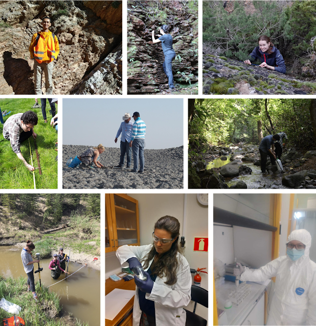
Our group of researchers (Early Stage Researcher - ESR) within the RAPID work package (WP2) are currently using a broad range of different investigative methods to study the effect of fast climate variations and weathering on different source to sink systems in different depositional environments.
1. Fluvial systems as an archive (e.g. Rhine-Meuse system)
Environmental signals can be well propagated by fluvial systems, such as rivers. These systems connect the source of sediments to the sink of their deposition. One way to investigate how rivers might propagate and store such signals is by studying river terraces. These terraces are structures formed when perturbation is caused and perceived by the river system (also referred to as watershed or catchment basin). The perturbation can be tectonic (e.g. uplift) or climatic (e.g.precipitation). In general terms, a terrace is formed by sediment deposition of a river (e.g. floodplain), but if a perturbation, like tectonic uplift, comes to affect this river system, there is a possibility that the system will respond by increasing incision rates of its river bed. Eventually, the previous river deposits will be completely cut and abandoned, thus, forming a river terrace. This terrace is of extreme importance to geoscientists because it stores information on past environments. For example, by analyzing grain size and shape, terrace thickness and type of sediment in terraces it is possible to obtain information on how the climate or even how the regional tectonic setting was during this terrace formation. Terraces become even more valuable to geoscientists when they can be dated (e.g. time of formation or time of abandonment), so that specific climatic and/or tectonic events can be linked to specific patterns found in the terraces. This is what ESR6 is conducting on the well preserved terraces of the Meuse river, a major tributary of the Rhine river, in the southern Netherlands. He is applying cosmogenic-dating techniques in order to determine when specific terrace levels were formed. The age of these terraces will help him integrate specific sedimentary and depositional characteristics of terraces with periods before and after the Mid-Pleistocene Climate Revolution.
Fluvial grain size distribution
Fluvial systems are found in the continents and are composed mostly by rivers and its catchments. Along these systems some regions tend to deposit sediments and they are usually called as alluvial fans, which are mostly cone shaped sedimentary deposits and they are usually found at the mouth of a mountain canyon. Fluvial deposits are valuable archives storing information about transport mechanisms of sediments on our Earth's surface.
An useful tool to reconstruct these processes is the analysis of the grain sizes of fluvial transported and deposited sediments. By considering distinct areas of the fluvial system, the distribution of the sediments' grain sizes are investigated. In order to describe the deposition of sediments along a river system , which usually shows a fining in grain sizes on the downstream direction, the grain size fining rates are generally determined. These rates are dependent on various mechanisms, which are long-lasting processes (e.g. tectonically driven uplifting and subsidence) or climatically induced rapid events. The latter are generally specified by the initial input of sediment characteristics (e.g. discharge amount, grain sizes) to the system. In this case, changes in water and sediment flux, potentially caused by spatial/quantitative precipitation variabilities, need to be investigated more precisely.
In the course of analyzing fluvial grain size distributions (ESR 8), one geological setting of interest is the Corinth Rift, central Greece (Fig.06). This tectonically active area includes a rift system where more than 70 rivers drain into the enclosed water-filled basin - the Gulf of Corinth. Watkins et al. (2020), focussing on sedimentary deposits at the mouth of the rivers, demonstrated the role of lithology (rock type) on grain sizes. Further analyses will include the determination of grain size fining rates downstream some of those river systems, which could reveal the impact of tectonics and climate on the rift. An additional interesting issue would be the comparison of grain sizes of geological modern sediments to deposits of the early Corinth Rift system (mid to upper Pleistocene), that might give insights into changing environmental conditions.
Fig.06: Corinth Rift, central Greece (Watkins et al. 2020)
In the study of the active fluvial systems, it is also very important to understand the impact of the rivers channelization and construction of dams on the sediment transport. The consequence of these changes can affect the economy related to the gravel resources and also the ecological systems that are found on the rivers and the floodplains. The majority of the rivers in Switzerland are now channelized with just a few rivers in their natural state, which makes it a nice place to conduct a study on the impact of the grain sizes rates between natural and modified rivers. With this objective the ESR 12 is taking a great number of grain size, slope and channel width measurements along two rivers (Fig.07) that are under the same climate and geological setting but one is highly modified (Gürbe River) with more than 60 check dams constructed and the other is mainly in its natural state (Sense River). The idea is to compare the measurements for both rivers and analyze how the anthropogenic influences can affect the grain sizes trends.
2. Glacial source-to-sink systems (e.g. North Sea Trough Mouth Fan)
Glaciations largely influence landscapes in the majority of mid- to high-latitude landscapes, from land to sea, with both erosional and depositional landforms. That makes glacial source-to-sink systems an archive of past and present global change.
Using high-resolution 3D seismic data, or ‘time pictures’ (Fig.08), of the subsurface of the North Sea Fan, ESR7 aims to characterize the main marine and terrestrial processes that were responsible for bringing sediment into the fan during the last 4.000 years of the last glaciation (known as Weichselian Glaciation), when the Fennonscadian Ice sheet covered northern Europe. One of the main goals is to evaluate if the high sedimentation rate observed in this period is a product of enhanced sediment production (due to high erosion rates of the glacier) or enhanced sediment transport (due to large volumes of meltwater).
Fig.08: 3D view of what the North Sea Fan seafloor looked like in the beginning of the last glaciation, with channels bringing sediment into the sink (Bellwald et al. 2020).
3. Paleocene-Eocene Thermal Maximum - PETM (e.g. South Pyrenees)
Rapid changes in climate have been documented in the past. One of the more intense and rapid occurred near 56 million years ago, between the Paleocene and Eocene periods. Although it was not as intense and brutal as nowadays’ climate change, it is one of the best comparative case studies. The Pyrenees provide extensive data on this event and over a whole source-to-sink system, which allows us to study the disruptions in several parameters.
One aspect is the changes in physical processes of sediment transport. The climate change involved a modification in the precipitation regime and therefore in floods occurrences and intensities. This changed the landscape from the continental areas, where rivers are thought to be more active, to the marine realm, with increased sediment income. We aim to quantify all those phenomenons to better understand how the landscape physically responds to a rapid change in climate.
4. Oceanic anoxic events (OAEs) and their effects on past oceans and S2S systems (e.g. Tethyan margin of Tunisia)
Anoxia is a state of the ocean which is attributed to dissolved oxygen depletion. Periods with widespread anoxia in the oceans are called oceanic anoxic events (OAEs) and are classified as geologically rapid and short-term climatic events and document major palaeoceanographic carbon-cycle related perturbations. They appear to have a global effect on the dynamics of past oceans and by extension on the S2S systems. Some are triggered by massive volcanic outgassing with immense CO2 release into the atmosphere which drives temperature increase leading to greenhouse climate, rising sea level, high nutrient fluxes due to increased weathering rates, increase in primary productivity, ocean acidification and possible calcification crises which can be recorded in the sediments of the basins as mass mortalities of organisms. Also, anoxic conditions can cause demise of fish and benthic organisms. Anoxia helps in preservation of organic matter in the sediments and it is frequent that during OAEs organic-rich strata are found in the form of black shales (petroleum source rocks). It is highly important to understand the characteristics and causes of these events and be able to model their evolution and project their effects on the oceans and S2S systems because it is evident that some of the phenomena that characterize them are starting to happen due to anthropogenic forcing. The planet is warming and certain conditions are now changing in a similar manner in the oceans such as ocean acidification and spreading ocean deoxygenation affecting the ecosystems already. ESR11 is working on the Tethyan margin of Tunisia and will examine the effects of such short-term climatic events (Aptian OAE1a and 1b) on the S2S system in two different long-term climatic settings from the less well-understood continental part to the deep sea.
The shaping of landscapes can be studied thanks to different tools. On the continent, river terraces, grain size trends found on river bars and the shape of channels can give us insights on the adaptation of the fluvial systems to a fast environmental change. Other techniques, such as seismic data, allows us to quantify sedimentation rates, and therefore potential evolutions in sediment production and transport. Those techniques are applied within this project both on ancient and modern deposits. Ancient climatic changes (e.g. the PETM and OAEs) provide insights on the whole recording of a fast change, from onset to recovery phases. Coupling this with the study of modern examples allows us to also take into account the impact of Human activities on sediment transport and production (e.g. river channelization and construction of dams). Making links between the different cases studied is therefore a crucial step for an overview understanding of how S2S systems react to fast environmental changes. With the presented tools we have a promising path to go from the rock record to an understanding of surface processes and up to predictions for the future. The use of models is also a key method for that purpose and will be integrated in each of our projects. This aspect will be more developed in a coming blog-post: stay tuned!
References:
Bellwald, B., Planke, S., Becker, L.W.M. and Myklebust, R. (2020). Meltwater sediment transport as the dominating process in mid-latitude trough mouth fan formation. Nature Communications vol.11, 46-45
Romans, B. W., Castelltort, S., Covault, J. A., Fildani, A. and Walsh, J. P. (2016). Environmental signal propagation in sedimentary systems across timescales. Earth-Science Reviews, vol.153, 7-29.
Watkins, S. E., Whittaker, A. C., Bell, R. E., Brooke, S. A. S., Ganti, V., Gawthorpe, R. L., McNeill, L. C. and Nixon, C. W. (2020). Straight from the source’s mouth: Controls on field-constrained sediment export across the entire active Corinth Rift, central Greece. Basin Research, vol.32, 1600-1925


Comments
Post a Comment