Posts

ITN opportunities: Summer-schools (Part 2)

Image
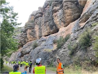
  Inside Africa: Fossil source-to-sink systems, the diamond case and an eolian story, Namibia, 2023 In May 2023, from the 06th to the 20th, we travelled 3500 kms through Namibia to follow two different source-to-sink systems: the diamond system in the South and the aeolian system further north.   Figure 1 Bogenfels ghost town, Sperrgebiet - Farewell at the Pink House The story of the diamonds is both old and young and starts with the diamonds being created within Jurassic Large Igneous Provinces - fields of volcanoes that were supplied with magma from the base of very thick and old continents and therefore can contain diamonds - all over Southern Africa. The craters were then eroded, sediments deposited in a sedimentary basin, which eventually was eroded too. The transport was interrupted by multiple tectonic tilts of the South African Plateau which impacted erosion and sediment transport, while extreme climate formed thick weathering profiles and crusts and thus enriched the se

ITN opportunities: Summer-schools (Part 1)

Image
Since the beginning of the project, multiple interesting opportunities have been presented to us. We would travel each year to conferences like EGU, present and convene, introduce ourselves to the scientific community, make connections, go on different secondments according to our needs during our doctoral studies, but also opportunities to meet each other during the years, with one important meeting for everyone each year: the summer schools. It was the only time where all of us were together for multiple weeks, to exchange, learn and evolve in our respective fields, but also learn in more detail about the subjects of our colleagues. Some cooperation started between us thanks to those summer schools. To cite some, Marine and Philémon during Dragonstone, in Spain in 2021 or Amanda, Rocío, Nahin, Ariel and Marine during Inside Africa, in Namibia in 2023. Thus, it is appropriate to present, through this blog, an overview about the summer schools. We could talk about each of them for da

Modeling in the Geosciences

Image
Numerical models are a novel tool used to predict changes, visualize processes, and identify relationships for the advance of scientific research. Models combine a culmination of years of scientific research in physics, statistics, and data collection into one place where scenarios can be interpreted and predicted. As with much of research within the geosciences, modelers have to reconcile with uncertainty and assumptions as they try to simplify the complexities of the real world into a comprehensible result. A modeler’s goal is not necessarily to recreate the exact reality of the geological world, but rather better define the bounds of what is possible or not possible in terms of processes, time, and scale to produce an observable phenomenon within data or physics. In the Geosciences, one type of tool and field of study are Landscape Evolution Models (or LEMs). They are used to recreate processes at the surface. Based on physical equations, it is possible to look at the evolution of h

Rapid Processes in Source-to-Sink Systems - part II

Image
In our blog post series, we previously mentioned how geological processes act in different time scales. These mechanisms can be long-lasting (e.g. tectonically driven orogenic uplift) or abrupt (climatic events). In our previous blog, post we introduced ‘fast’ processes shaping the source-to-sink systems. We also gave some examples, which had major impacts on human populations. In this post, we will explore the sedimentological record as a key to understanding past events, and predicting future ones. We will also explore some key events that have helped us understand past climates with the sedimentological records; some of which our ESRs will study to incorporate into models. This will help them to predict future climatic impacts in the rapid climatic change that we currently experience. The rock record as an answer for the future Environmental signals (originated from climatic or tectonic processes) can be preserved within the stratigraphy of depositional basins and in the physical fe

Rapid Processes in Source-to-Sink Systems - Part I

Image
In our blog post series, we previously mentioned how geological processes act in different time scales. These mechanisms are either long-lasting (e.g. tectonically driven orogenic uplift) or abrupt (climatic events). Within our previous blog post, we focused on the former -  those processes considered to be ‘slow’ in the geological time scale, going back from several decades to millions of years in our Earth’s history. In this post we will dive into much faster processes that shape the surface of our planet. These processes can take place within hours, days, or even years up to several thousands of years (Romans et al. 2016). Surface processes vary with environmental changes  The Earth’s surface is a natural archive that stores information on past environmental conditions. This information can be found in the landscape shape, in rocks, sediments, and minerals. Changes and perturbations in the environment, for example, floods and landslides, resulting in changes in the landscape. These

What is a “Slow” Process in a Source-to-Sink System?

Image
The timescale of geological processes is very extensive. “Fast” processes like earthquakes, storms, or tides last from a couple of minutes to weeks. “Slow” processes, like orogenic uplifts or continent break-ups on the contrary can take up to millions of years (Fig. 1). In this post we will look into these slow processes in the context of the source-to-sink approach, introducing some concepts that provide a useful framework to understand the dynamics of these long processes in sedimentary systems. Figure 1. Temporal scale showing the differences in terms of duration of several geological processes as well as the common tools used to measure them. Bear in mind that the scale is logarithmic. Modified from Romans et al ., 2016. To understand slow geological processes in the context of source-to-sink analysis, we first have to understand the concept of steady-state topography. There are two major processes that drive topography inside a catchment (Fig. 2), one that creates positive rel

Methods to Investigate Source-to-Sink Systems

Image
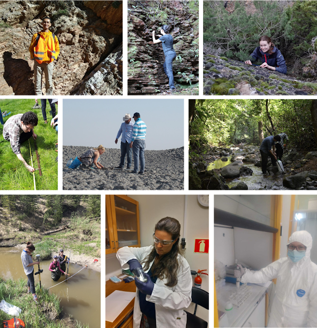
ESRs in the field and in the lab. The sample processing starts by describing, counting, measuring, sampling, and investigating in the field. Samples are then taken to the laboratory for analytical work. Keep up with future posts to see the field and laboratory results! Much like building a complex puzzle, multiple components come together to foster an understanding of the evolution of S2S systems at various temporal and spatial scales. Some of these components are (1) understanding the major processes and fluvial dynamics acting on the system, (2) recognizing the changes or signals in the sedimentary record, (3) deciphering the environment necessary to produce a given signal within the record, and (4) contemplating other dynamics that would change the expression of an environmental event in the final rock/sediment record. Thus, studying S2S systems often requires an integration of research methods and the collaboration of specialists across different fields.     Pieces of the puzzle;